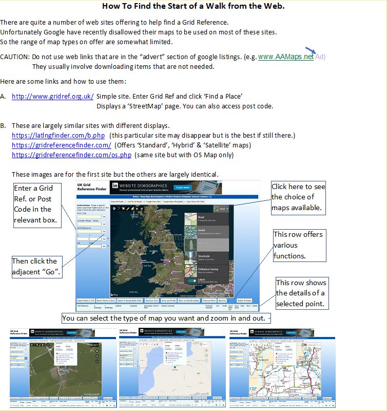
Most Walks include the Grid Reference of the start location of the walk.
Without a relevant OS map and an understanding of Grid References it can be
difficult to work out where the walk starts.
They may also include a Post Code, though these are at best an approximate to the start point.
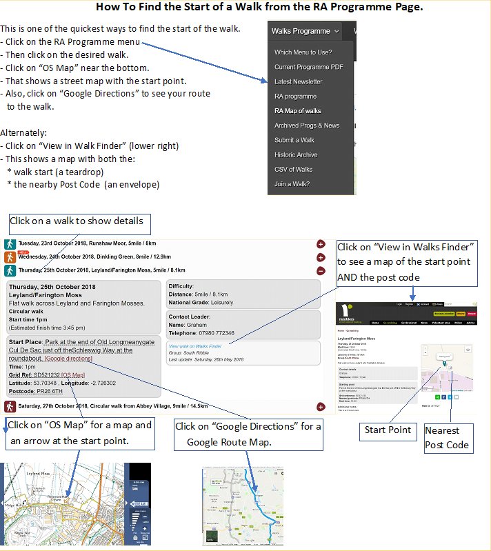
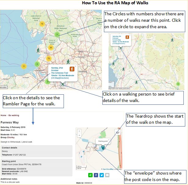
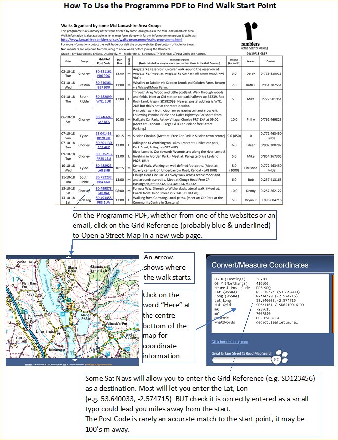
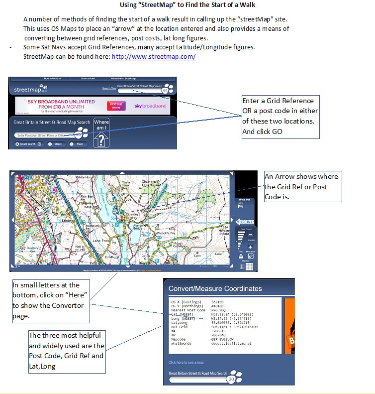
Here are explanations of five ways to find a map of a walk location and some of the Pros & Cons.
Three of the methods use facilities on this site, and two on the general web.
| Method (click to popup) | Pros | Cons |
| RA Programme | Only 2 or 3 clicks to a map. OS map, Google Directions, See where Post code is. |
Only applies to Rambler Walks |
| RA Map of Walks | a few clicks to a map. See where Post Code is. |
Only applies to Rambler Walks |
| Current Programme PDF | 2 clicks to Street Map | Only applies to Rambler Walks |
| StreetMap | Can be used for any Reference. Used by most options. Includes Convertions |
Requires typing in Post Code or Grid Reference |
| Grid Reference Finder | Can be used for any Reference. | Requires typing in Post Code or Grid Reference |
| Dowload a PDF with all of these instructions | ||